Following in the Footsteps of Antiquarians at Castle Law
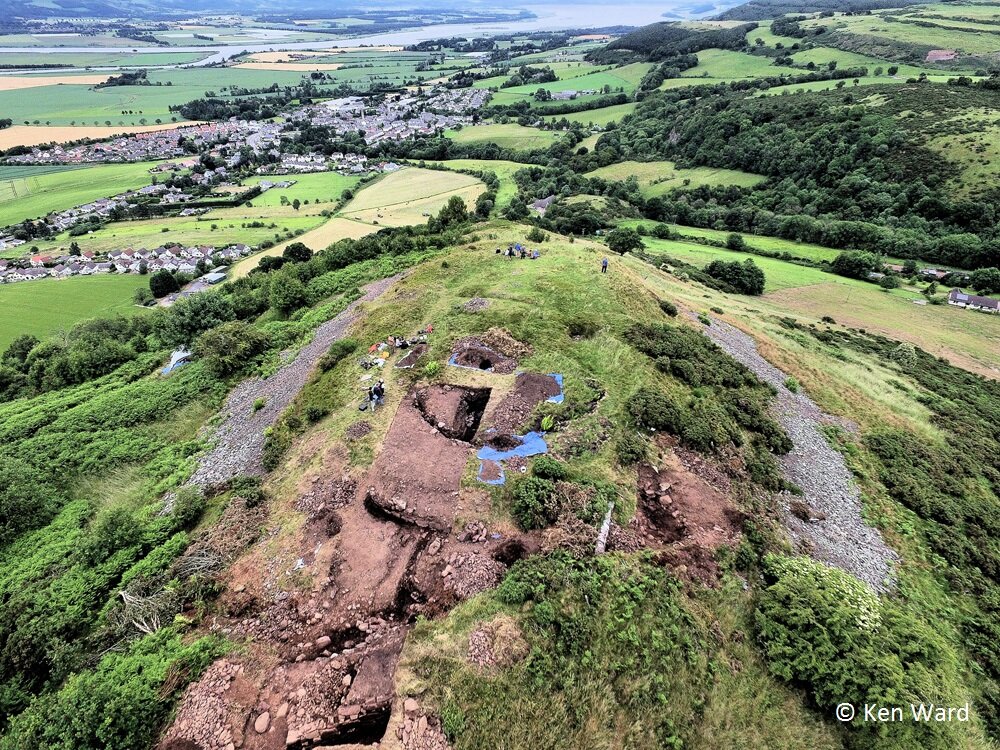
In the summer of 2017, AOC supported Perth & Kinross Heritage Trust in investigating the hilltop on Castle Law, Abernethy. Work was undertaken as part of Tay Landscape Partnership, and provided a bridge between two of its projects: Hillforts: Seats of Power and Abernethy: Discover & Explore. After two successful Wee Big Digs in Abernethy (with a third not long after our excavations on the hillfort) and the completion of work on Moncrieffe Hill, the team of archaeologists and community volunteers were looking forward for another chance to uncover more about the history of this area.
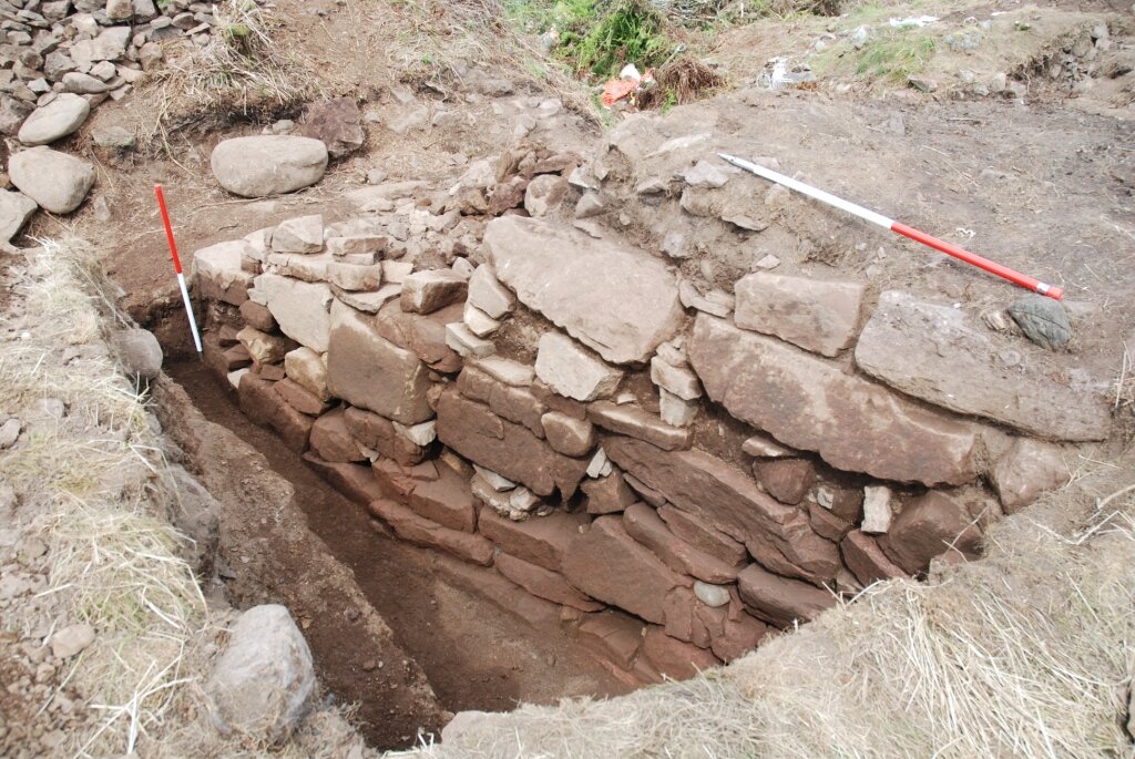
One of the interesting things about Castle Law is that it had been excavated previously. Castle Law Hillfort site saw important antiquarian excavations in the 1890’s, initiated by interested local gentlemen, and subsequently recorded by David Christison. In addition to evidence for inner and outer ramparts and a rock cut cistern, the excavations discovered a jet ring, bronze finger-ring, and bronze fibula. Although these excavations revealed a good level of preservation of the enclosure wall on the site and produced a significant range of artefacts, including relatively high-status items. Being before the introduction of C14 dating, however, it was clear that a focus of our excavation was to obtain evidence to enable us to understand the date and chronology of the site.
Our excavations focused on a 6mx 25m trench across the inner and outer ramparts, and a further smaller trench investigating features mentioned in the original excavation report which appeared to connect the ramparts. Contrasting to current practice, it appears not much backfilling had been done, leaving these ramparts exposed. As such, our aim was to not only conduct limited excavation in order to assess the date of the site, but to assess the condition of the site 120 years after the excavation. Post-excavation is still ongoing, yet the excavations themselves revealed some interesting results.
Excavation across the walls confirmed the general construction method in which large blocks of both old red sandstone and local stone, were roughly dressed and built around a timber laced framework. The timber lacing was identified in the external face but not the internal area. On the inner wall, only one course was identified, although the previous works identified at least three courses. The original excavation also identified a series of transverse timbers, but these were not identified due to the limit of the work. it was clear the ramparts have suffered damage due to the exposure as a consequence of the lack of backfilling, however the outer face of the outer rampart was especially well preserved.
A stone setting was found within the upper citadel, and during excavation it was clear the mound identified topographically was simply upcast and rubble not backfilled from earlier investigations of the inner wall face. However, above the setting was a fragment of crucible and several instances of characteristically prehistoric ceramic.
The excavations at Castle Law provided a rare opportunity to excavate a nationally significant monument, a classic Scottish type site, and provide new information on the date and function of the site, and its ongoing conservation and management.
This project was delivered as part of Tay Landscape Partnership, which is supported by the National Lottery through the Heritage Lottery Fund.